
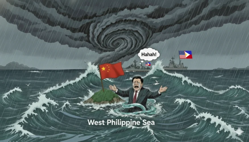
The Attractor
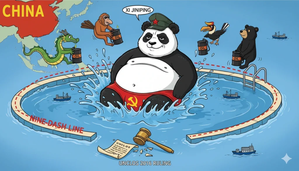
The South China / West Philippine Seas are a strategically vital ocean region, encompassing critical shipping lanes that facilitate approximately one-third of global trade and holding hydrocarbon reserves estimated at 11 billion barrels of oil and 190 trillion cubic feet of natural gas. Until 2013, Vietnam, Malaysia, Brunei, Indonesia and Taiwan all shared peaceful stewardship of the area. Then a big, fat panda plopped down into the pool, pushing everyone else out like a sumo wrestler in a Jacuzzi.
Unable to find oil and gas deposits enough to supply long-term energy requirements within China’s mainland boundaries, Xi Jinping ordered his military to take de facto possession of the most promising zones within the so-called “nine dash line” created by the Republic of China under Chiang Kai-shek in 1947. Despite the 2016 UNCLOS ruling that nullifies the claim, China has continued to squat thereon.
For the past 13 years, the People’s Republic of China (PRC) has undertaken extensive land reclamation projects in the southern Spratlys, transforming submerged reefs and seamounts into artificial islands totaling over 3,000 acres. These efforts, concentrated on features barely above the waves during extreme high tides, involve dredging coral reefs and depositing sediment to create habitable land, equipped with airstrips, harbors, and military facilities.
While these islands bolster China’s military presence and claims over disputed waters, they are inherently vulnerable to the region’s active tectonics and frequent extreme weather events. The region lies atop seismic zones, including the Manila Trench, where earthquakes can trigger seabed liquefaction, a process where saturated sediments lose strength and behave like a fluid, causing structures to sink or collapse.
Additionally, the area is situated smack in the middle of typhoon alley, with superstorms capable of generating surges that inundate low-lying reclaimed lands, and high winds that can collapse even hardened aircraft hangars. This places considerable pressure on the People’s Liberation Army Navy (PLAN)’s ability to repair, maintain and protect facilities with equipment susceptible to seawater damage.
Construction Methods and Environmental Impact
China’s island-building process involves “cutter-suction” dredgers that excavate coral and sediment from the seabed, pumping it onto reefs to form landmasses. At Fiery Cross Reef, for instance, reclamation created a 274-hectare island with a 3,000-meter (nearly 10,000 feet) runway and a deepwater harbor, while Mischief Reef spans over eight miles in circumference, rivaling Pearl Harbor in scale. Subi Reef features a massive, enclosed harbor and extensive facilities. These sites, built on calcareous sands and coral fragments, are prone to instability because the underlying materials are loosely packed and water-saturated, conditions ideal for liquefaction during seismic events.
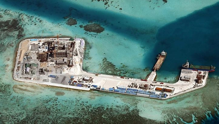
Environmentally, the construction has devastated coral ecosystems, burying over 4,600 acres of reefs and causing sedimentation plumes that smother marine life. This degradation not only exacerbates erosion but also reduces the natural buffering capacity of reefs against waves and surges, heightening vulnerability to typhoons. The isolation of these oceanic atolls means recovery from such disturbances could take many decades and cost hundreds of millions, if not billions, of Dollars.
Seismic Risks and Liquefaction Potential
The SCS is seismically active, bordered by subduction zones like the Manila Trench, where megathrust earthquakes could generate tsunamis propagating across the basin. Historical events, such as the 1918 Nan’ao earthquake (magnitude 7.3), underscore the threat. Reclaimed islands constructed on unconsolidated sands are particularly susceptible to liquefaction, where ground shaking causes pore pressure buildup, leading to strata failure and subsidence.
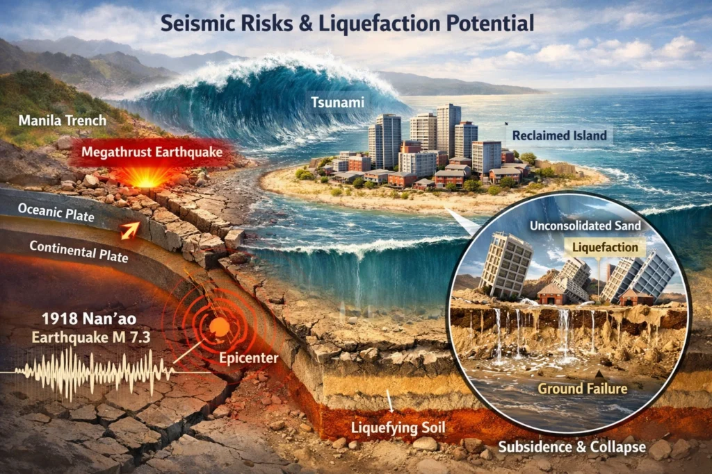
Calcareous sands used in the area, while somewhat resistant, remain at high risk under strong seismic loads. For example, during the 2011 Tohoku earthquake, offshore liquefaction caused severe infrastructure tilting. In the SCS, a magnitude 8+ event near the Manila Trench could induce waves up to 2-3 meters in Hong Kong, implying similar or greater impacts on exposed islands like Mischief Reef. Liquefaction could result in uneven settlement, cracking runways, and collapsing structures, rendering PLAN bases inoperable and exposing any subsurface installations to seawater intrusion.
Typhoon Vulnerabilities and Inundation Risks
The SCS experiences 20-30 tropical cyclones annually, with super typhoons like Ragasa (2025) generating winds over 240 km/h and surges exceeding 6 meters. These low-lying artificial islands, often just meters above sea level, are highly vulnerable to erosion and flooding. Fiery Cross Reef, for instance, has already required repairs after edge collapse. Typhoon Melor (2015) eroded Vietnamese reclamation on nearby reefs, illustrating the fragility.
Super typhoons could inundate facilities, damaging electronics and infrastructure. Climate change intensifies these storms with increasing frequency and severity, potentially leading to fisheries collapse and heightened operational risks for PLAN. Rising sea levels further threaten submersion without expensive, ongoing maintenance.
Risks to Concealed Resource Extraction Infrastructure
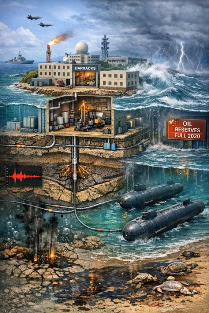
Intel-driven beliefs persist that China’s islands conceal oil and gas fracking equipment within hollow, square structures made to look like barracks or office buildings to evade detection while exploiting reserves in the area. China has conducted explorations, such as a 2014 gas find, and the harbors have been dredged out to exceptional depths. This suggests either flexible pipelining has been lain back to Hainan Island, or tanker subs concealed by deep water were being used. Hydrofracking involves seismic surveys and drilling that disrupt seabed’s, potentially exacerbating liquefaction risks.
Typhoon-induced inundation could flood such equipment with seawater, causing corrosion and operational failure due to salt damage to sensitive machinery. Seismic events might fracture wells, leading to leaks that compound environmental harm already evident from reclamation. Environmental damage was cut short when activity on the islands came to a halt in July of 2020, after China was able to fill up its 100-year reserves as the price of oil and gas dropped to virtually nil due to the Covid pandemic.
Not a Question Of “If”, But “When”
China’s artificial islands in the SCS/WPS expose the PLAN to significant natural risks. Liquefaction from earthquakes would cause sinking, while super typhoons threaten inundation and erosion, potentially disrupting military and any concealed extraction operations, were they to be restarted.
No longer of viable military or commercial use, the casual observer could possibly envision these properties as ideal tourism destinations, potentially leased out by the Chinese government to gaming and hospitality industry giants. In that way, the abovementioned vulnerabilities would be mitigated, and a friendlier, less-confrontational approach to island-building is adopted by Beijing.